The Focus i.1 X combines a 400-meter scanning range with a mountable GNSS/RTK receiver for outdoor projects.
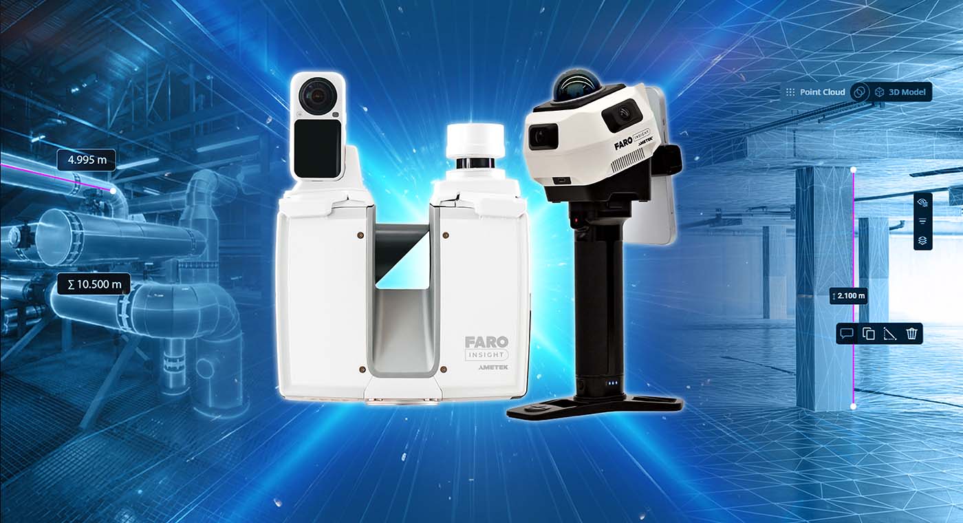
FARO INSIGHT, a business unit of AMETEK, Inc., has added the Focus i.1 and Focus i.1 X terrestrial laser scanners and the Rovi i.1 reality capture package to its portfolio. The products are being presented at INTERGEO in Munich and Autodesk University in Las Vegas.
The Focus i.1 and Focus i.1 X are terrestrial laser scanners for capturing spatial data used to document and measure physical environments. The systems include updated hardware, object accuracy of up to 0.9 mm, faster colorized scanning and positioning technologies.
The scanners are designed for architecture, engineering, construction and operations (AECO), geospatial and public safety applications. The Focus i.1 X includes a mountable GNSS/RTK receiver and a 400-meter scanning range for outdoor data capture and georeferencing.
Focus scanners support cloud-based collaboration through the FARO Sphere XG digital reality platform. Users can also process data and apply AI-based data cleaning in SCENE through a subscription model that supports access to connected reality capture workflows.
FARO INSIGHT is introducing Rovi i.1 in partnership with Manifold Tech Limited, a 3D spatial intelligence technology company. The package combines a mobile scanning device with software subscriptions that connect data capture, processing in FARO Sphere XG and project analysis in SCENE.
FARO INSIGHT is also announcing updates that connect reality capture with processing and downstream project workflows. SCENE 2027, an update to the desktop processing software, is intended to reduce point-cloud generation time for large projects from hours to minutes. It will also include an AI-based filter for removing glass and mirror reflections.
Another update is a cloud-to-cloud workflow with Flyability’s Inspector Online. The workflow will use FARO SLAM technology to process data captured by Elios 3 drones in confined or difficult-to-access spaces. Point-cloud data will be transferred directly between Inspector Online and the FARO platform.
Forthcoming Sphere XG features will support project deliverables. Integrated Projects (IPX), a scan-to-BIM service, will allow users to order as-built BIM models generated from captured point clouds within the platform. An integration with Qbitec, expected later in 2026, is planned to transfer Sphere XG data into additional project workflows.
For more information, visit faro.com.